High-performance hybrid urban mapping sensor combining 2 MHz linear-mode LiDAR with two nadir cameras (RGB + NIR) and four 150 MP oblique cameras — all captured in a single pass. The world's only combined oblique imaging and LiDAR system.
Dual-wavelength airborne topo-bathymetric LiDAR combining a 1064 nm topographic channel with a 532 nm green channel for shallow water penetration. Simultaneously collects topographic and bathymetric data in a single flight, ideal for coastal, riverine, and wetland mapping.
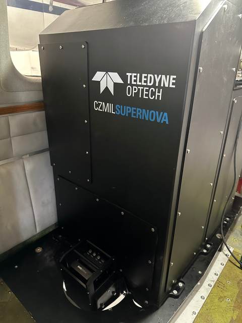
Advanced full-waveform topo-bathymetric LiDAR for coastal zone mapping. The SuperNova combines deep water penetration capability with high-density topographic collection, enabling seamless land-to-sea data capture in a single sortie. Widely used for NOAA and military hydrographic programs.

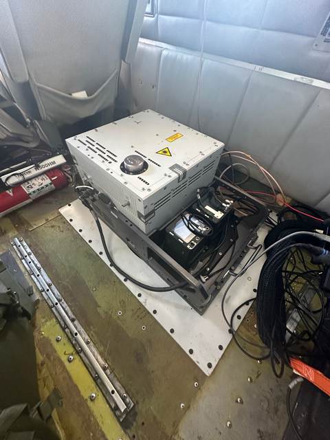
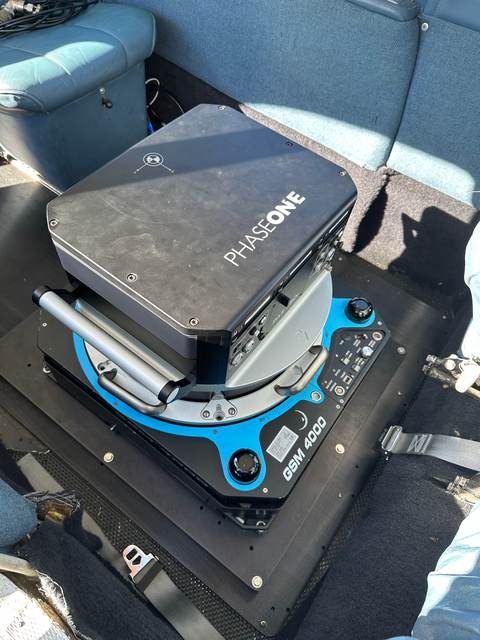
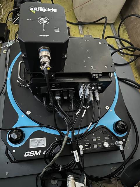
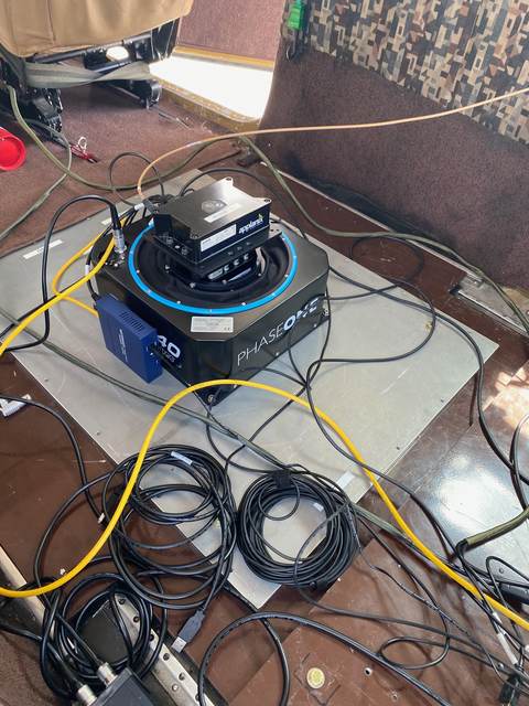
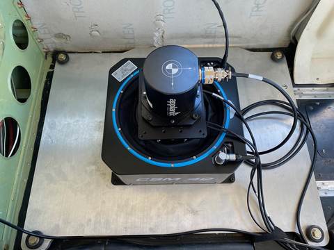
High-density topographic LiDAR sensor delivering up to 2 MHz pulse repetition frequency for large-area terrain mapping. Supports simultaneous RGB and NIR imagery collection via the PhaseOne IXU-1000, enabling single-pass LiDAR + imagery acquisition.
Versatile medium-density airborne LiDAR ideal for corridor mapping, powerline surveys, and broad-area topographic collection. Like the T2000, the Orion M300 supports simultaneous PhaseOne IXU-1000 imagery co-collection for combined LiDAR and RGB/NIR datasets.
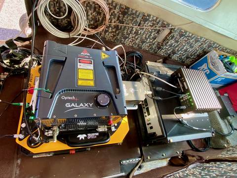
High-performance topographic LiDAR combining the Optech Galaxy platform with ALTM PulseTRAK technology for extremely high pulse repetition rates. The Galaxy Prime delivers dense point clouds at high aircraft speeds, making it highly efficient for large-area terrain and corridor mapping programs.
Compact, lightweight full-waveform airborne LiDAR scanner with online waveform processing. The VQ-580 II-S features a wide scan angle and high measurement rate, suited for topographic mapping, vegetation analysis, and corridor surveys from small aircraft.
Single-photon sensitive Geiger-mode LiDAR enabling extremely high-altitude collection with ultra-high point densities. Geiger-mode avalanche photodiode technology allows detection of single photons, dramatically increasing collection efficiency and enabling wide-area mapping at speeds and altitudes impractical for conventional LiDAR.
High-resolution large-format aerial camera system delivering 150 MP imagery for demanding photogrammetry and orthoimagery applications. Capable of RGB and NIR configurations, the PAS880 provides exceptional detail for large-area mapping at higher altitudes.
Our primary photogrammetry sensor. The PAS280 captures high-resolution nadir imagery with simultaneous Near Infrared (NIR) capability, enabling single-pass RGB and NIR collection for vegetation analysis, agricultural applications, and precision orthoimagery production.
The first wide-area aerial camera built around a CMOS global shutter sensor — eliminating mechanical parts entirely and enabling shutter speeds up to 1/16,000 sec with zero rolling shutter distortion. The single-sensor 120 MP design captures massive coverage per frame without stitching, and its high-sensitivity, low-noise characteristics extend the operational window into low-light conditions.
Versatile medium-format aerial camera suited for a broad range of photogrammetric and mapping applications. The PAS150 provides an excellent balance of resolution, swath width, and operational flexibility across varying altitudes and project types.
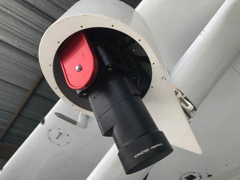
Compact 100 MP aerial camera designed for integration with Teledyne Optech LiDAR systems (T2000 and Orion M300). Available in RGB or NIR configurations, the IXU-1000 enables simultaneous high-resolution imagery and LiDAR collection, maximizing data output per flight hour.
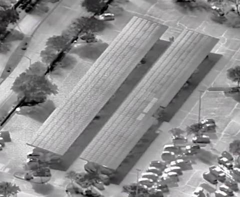
Radiometric thermal infrared sensor delivering high-sensitivity thermal imagery for solar panel inspection, infrastructure assessment, and environmental monitoring. The 8580 series provides calibrated temperature measurements across wide area coverage, enabling quantitative thermal analysis from altitude.
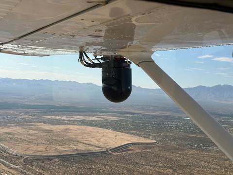
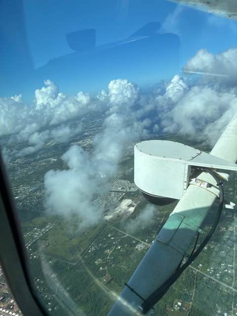
Stabilized multi-spectral EO/IR gimbal system used in ISR, law enforcement, and special mission applications. The MX-10 provides continuous optical tracking with EO and IR capabilities in a compact, gyro-stabilized turret, offering persistent situational awareness from manned aircraft.
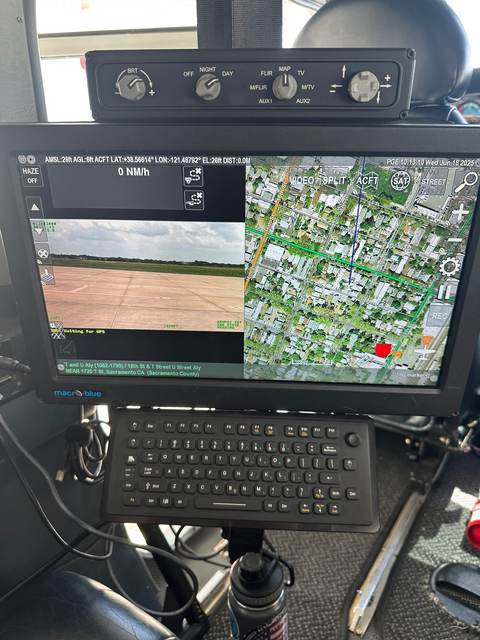
Augmented Reality System that works in conjunction with airborne gimbals to overlay geospatial data, navigation information, and mission-critical metadata directly onto live gimbal video. The ARS enables operators to visualize coordinates, boundaries, targets, and other contextual data fused with the real-time aerial feed — significantly enhancing situational awareness for ISR, law enforcement, and special mission operations.
Specialized 3D airborne sensor platform designed for advanced geospatial data collection and analysis. The Simplex 3D system provides a compact, integrated approach to airborne 3D data capture for research, government, and commercial applications requiring non-standard sensor configurations.
Patented multi-camera 360° aerial imaging system developed by Phoenix-based AerialSphere. The rig used four Sony a7R IV full-frame mirrorless cameras fitted with Rokinon 12mm f/2.0 lenses, angled downward beneath the aircraft for near-complete spherical ground coverage. GPS-triggered capture collected imagery at fixed intervals every half mile, producing immersive 360° aerial panoramas integrated with location data for GIS, real estate, and urban visualization platforms. AerialSphere has since ceased operations.
Don't See Your Sensor?
We operate as a sensor-agnostic platform. If your sensor isn't listed, contact us — we regularly integrate new payloads and can discuss your specific integration requirements under NDA.
Discuss Integration