Talos Aviation fleet in hangar
Services & Fleet

Services &
Aircraft Fleet

How Talos works, the sensor classes we fly for our partners, and the aircraft that carry them. We are the airborne acquisition layer — sensors and processing come through our partner network, with light in-house processing now emerging.

How We Work Photogrammetry LiDAR Special Missions Our Fleet

A Sensor-Agnostic Airborne Platform

Talos Aviation Group is the flying half of the survey equation. We do not own sensors and we are not a data-processing house — we provide the certified aircraft, experienced survey crews, and mission execution that get a sensor over the target and bring the data home cleanly. Because we do not own a mapping division, we never compete with our clients for their downstream deliverable work — your client list, project intelligence, and margins stay yours. The sensors come from our partners, and on most programs those same partners handle processing and delivery.

Primary Model

Leased-Sensor Acquisition

We lease the right sensor from a partner company, integrate it on the best-matched aircraft, and fly the mission to spec. Our partner then performs all data processing and delivers the finished products. You get partner-grade deliverables backed by Talos flight operations.

Division of work
Talos — aircraft, crew, flight planning, acquisition, raw-data QA
Partner — the sensor, full processing, and final product delivery
Emerging Model

End-to-End · Partner-Owned Sensors

For partners who fly their own sensors with us, we are building an end-to-end path: we operate the sensor through the full mission and are now beginning to provide light in-house processing and delivery alongside acquisition. This capability is early and expanding — we scope it honestly on a per-project basis.

Division of work
Talos — aircraft, crew, end-to-end acquisition
Talos (new) — light processing & delivery
Partner — the sensor (partner-owned)
The Bottom Line Whatever the sensor, Talos provides the airborne platform. We will help match the right sensor partner and aircraft to your project, coordinate the leasing or integration, and own the flight-operations end of the program from planning through clean data handoff. On program engagements, that ownership is explicit: a committed acquisition window, a named primary and backup aircraft, and scheduled status reporting from mobilization through handoff — so you always know where your data stands.

Photogrammetry

We fly high-resolution photogrammetry sensors provided through our partners — large-format systems in the class of the PhaseOne PAS280, including Near Infrared (NIR)-capable configurations for vegetation, agricultural, and environmental work. Talos plans the flight lines and captures the imagery; our sensor partner processes it into orthomosaics, surface models, and point clouds and delivers the finished products.

Sensors are flown with IMU integration and ABGPS control for direct georeferencing, at ground sample distances (GSD) from 1 cm to 30 cm depending on altitude and project requirements. On end-to-end engagements with partner-owned sensors, we are beginning to provide light first-look products in-house.

Typical Turnaround Partner orthomosaic delivery: 5–10 business days from flight. Rush handling available for emergency and government projects.
Sensors We Fly · Photogrammetry
ParameterSpecification
Sensor classPhaseOne PAS280-class, partner-provided (nadir + NIR capable)
GSD range1 cm – 30 cm (altitude-dependent)
PositioningIMU + ABGPS, PPK-corrected
Flight altitude1,000 – 12,000 ft AGL
Overlap60–80% forward, 30–60% side
NIR collectionAvailable simultaneously with RGB
CoverageUp to 600 sq mi/day (altitude/GSD dependent)
Mission-planned, spec-compliant image acquisition
Raw imagery with flight logs and sensor trajectory
On-site acquisition QA and reflight assurance
Georeferenced orthomosaics (GeoTIFF)
Digital Surface Models (DSM) and Digital Terrain Models (DTM)
Dense 3D point clouds (LAS/LAZ)
NIR orthomosaics (vegetation index, NDVI-ready)
Flight reports and camera calibration certificates
Coordinate system: client-specified (NAD83, WGS84, State Plane)

LiDAR Operations

We fly partner LiDAR systems for terrain modeling, vegetation analysis, powerline corridor inspection, floodplain delineation, and infrastructure mapping — discrete-return and combined LiDAR/imagery platforms in the class of the Optech T2000, Leica CityMapper2, and Optech Orion M300, several with co-collected RGB/NIR via the PhaseOne IXU-1000. All are flown with precision IMU/GNSS for direct, survey-grade georeferencing.

Talos executes the acquisition to spec; the sensor partner classifies and processes the point cloud and delivers the final products. For partner-owned sensors under our emerging end-to-end model, we are beginning to provide light in-house processing.

Typical Turnaround Partner classified LAS/LAZ delivery: 7–14 business days. Ground-controlled final products: 10–21 days. Rush handling available.
Sensors We Fly · LiDAR
ParameterSpecification
LiDAR sensor classOptech T2000, Leica CityMapper2, Optech Orion M300 (partner-provided)
Point density2–20 pts/m² (mission-configurable)
Vertical accuracy≤ 10 cm RMSE (ground conditions dependent)
Horizontal accuracy≤ 20 cm RMSE
RGB/NIR co-collectionPhaseOne IXU-1000 (RGB or NIR) with Optech sensors
Oblique imageryVia Leica CityMapper2 (nadir + oblique simultaneously)
Flight altitude500 – 6,000 ft AGL
Max swath widthUp to 2× flight altitude
Spec-compliant LiDAR acquisition with planned point density
Raw point data, trajectory, and flight/sensor logs
On-site acquisition QA/QC and reflight assurance
Classified LAS/LAZ point cloud (ground, veg, structure)
Bare-earth DTM and DSM rasters
Intensity imagery
Contour generation (1 ft, 2 ft intervals)
Breaklines and hydro-flattened terrain
Flight and sensor QA/QC reports

Special Missions

Talos Aviation Group was veteran-founded and operates with a mission-first mindset that directly translates to non-standard aviation operations. We work with government agencies, defense contractors, and research institutions on missions that require discretion, precision, and operational flexibility.

Special missions range from managed flight operations supporting third-party sensor programs, to persistent surveillance, to airborne test operations for prototype sensors and payloads. We bring the aircraft, the crew, and the operational structure — you bring the mission.

Note on Sensitivity Some special mission capabilities are not publicly listed. Contact us directly to discuss project-specific requirements under NDA.
Capability Areas
Managed Flight Operations
Full crew and aircraft provision for client-directed missions
Sensor Integration Support
Aircraft modified for custom payload, power, and data interfaces
Persistent Area Surveillance
Long-endurance loiter operations over defined areas of interest
Rapid Response Deployment
Emergency tasking from either base within hours of notification
Night / Low-Visibility Operations
IFR-qualified crews, NVG-compatible cockpit configurations available
Multi-Aircraft Coordination
Simultaneous multi-ship operations for large-area coverage

Sensor Testing & Integration

Hardware developers and research organizations need an experienced airborne test platform — not just a plane, but a team that understands what it means to integrate a new sensor, run it in varying conditions, and produce useful test data.

Our aircraft offer configurable hard points, power ports, and data routing. Our crews understand sensor operation and can execute precise test patterns — constant altitude, fixed speed, calibrated turns — required for repeatable sensor characterization.

Typical Engagement Sensor integration pre-survey: 1–5 days. Test flights: 1 day to multi-week depending on program. We operate at client facilities if required.
Test Platform Capabilities
FeatureDetail
Camera portsBelly ports, nose mount, wing hard points (aircraft-dependent)
Power provision28V DC / 115V AC available; load-dependent
Data interfacesGigE, USB 3.0, RS-232/422, custom on request
Navigation data outReal-time IMU/GNSS NMEA / custom protocol
Crew familiaritySurvey-experienced; pattern flying, exact speed/altitude holds
Operating environmentSea level – 17,500 ft MSL; any CONUS location
Endurance4–7 hrs depending on aircraft and payload weight

Processing & Delivery

On most Talos programs, data processing and final delivery are handled by the partner whose sensor we fly. That is the standard leased-sensor model — and it means your products are built by the team that knows the sensor best, to recognized accuracy standards. Talos owns the acquisition and the clean handoff of raw data, trajectories, and flight logs.

We are now beginning to build a light in-house processing capability for end-to-end engagements on partner-owned sensors. Today that covers first-look products and quality checks; we are expanding it deliberately rather than overpromising.

Need a Full Mapping Deliverable? Tell us the product you need and the accuracy standard it must meet — we will fly the acquisition and coordinate the right processing partner to deliver it.
Who Does What
Aircraft & Flight Operations
Talos — planning, crews, and mission execution
The Sensor
Partner — leased to Talos, or partner-owned and flown by us
Raw-Data QA & Handoff
Talos — field QA, secure transfer of imagery/point data and logs
Full Processing & Final Delivery
Sensor partner — standard on the primary leased-sensor model
Light Processing & Delivery
Talos — emerging, for partner-owned end-to-end engagements
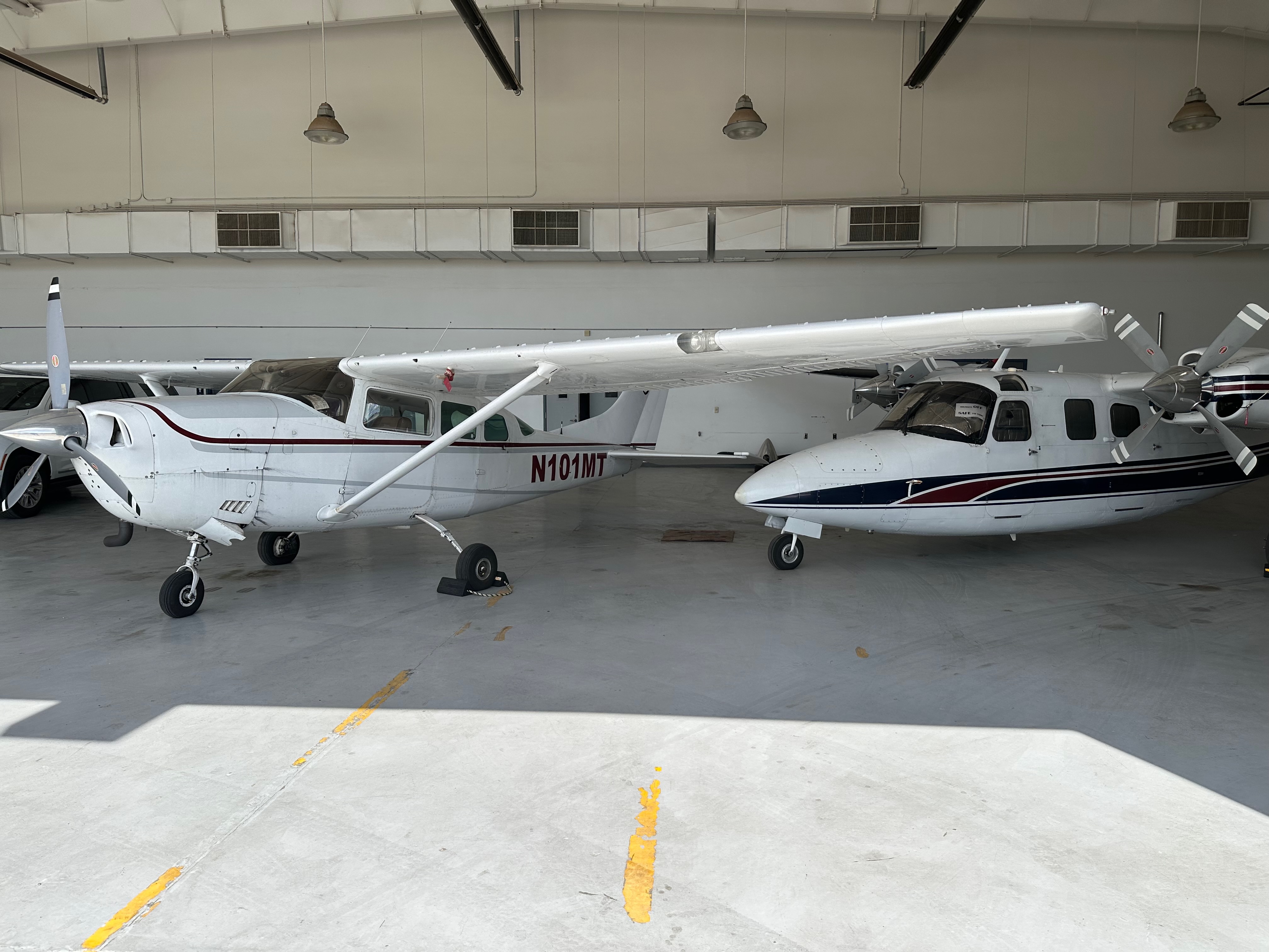
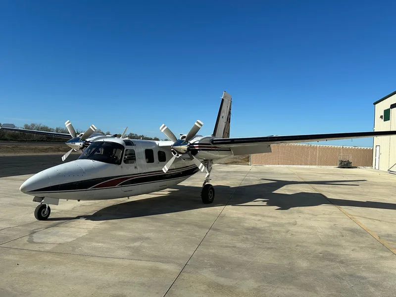
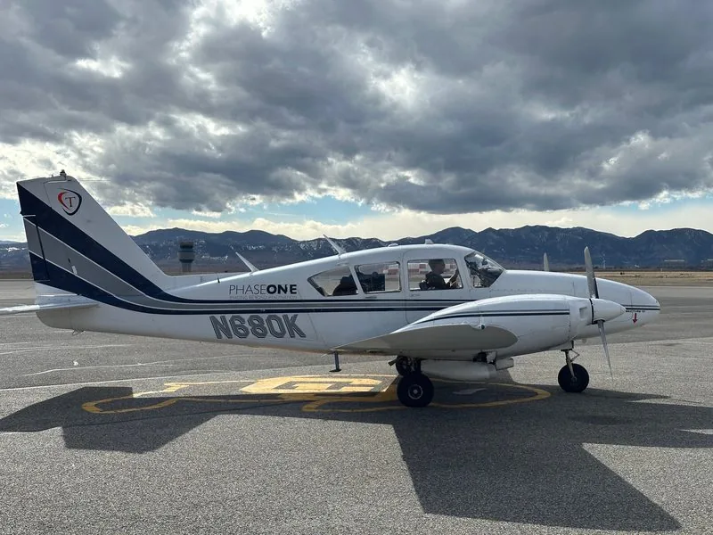
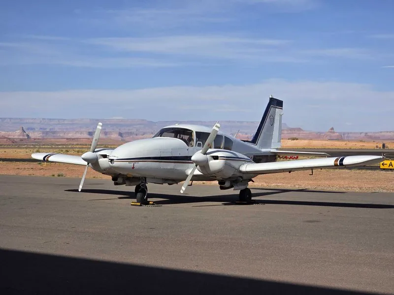
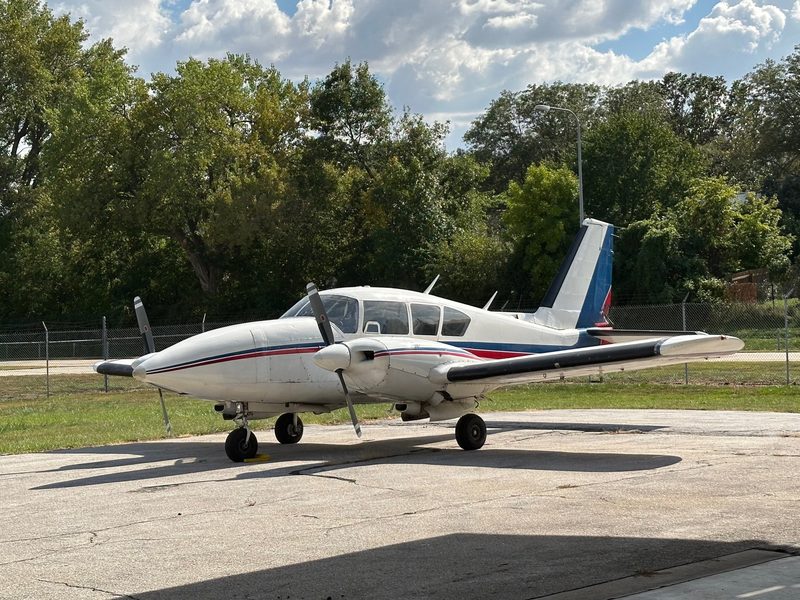
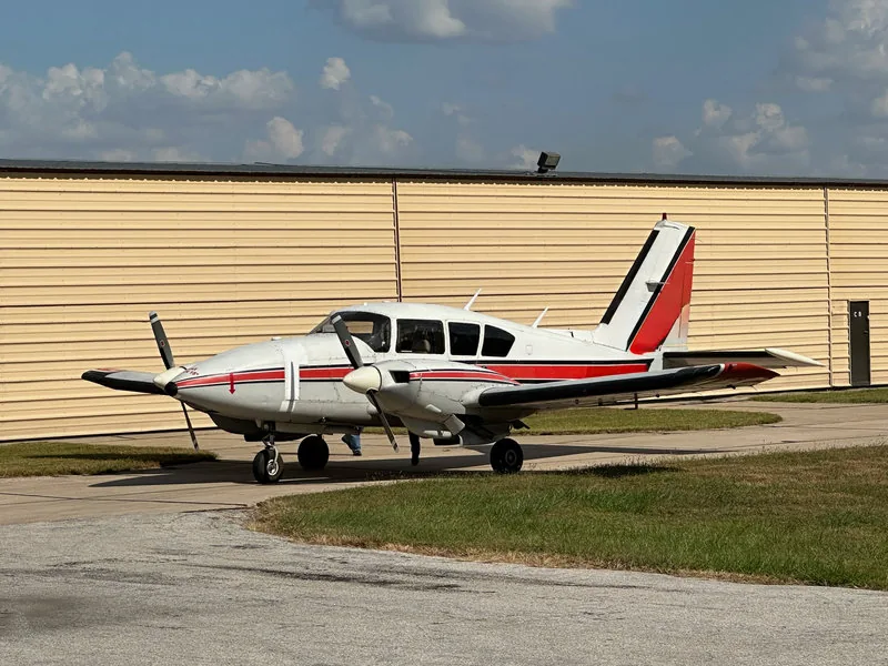
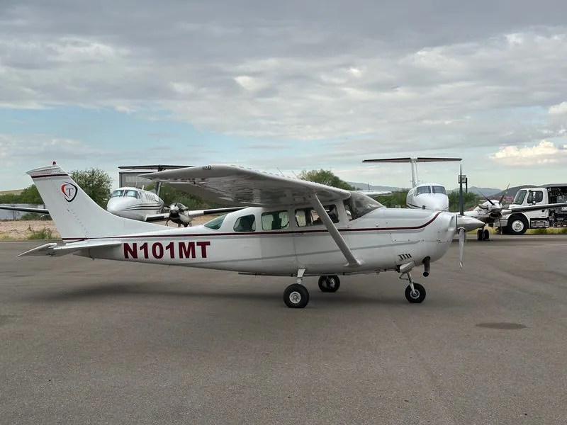
Color-balanced, edge-matched orthoimagery
Topographic mapping to ASPRS accuracy classes
Planimetric feature extraction (attributed GIS layers)
3D building models and change detection

Our Fleet

Six purpose-modified aircraft covering everything from single-sensor corridor flights to multi-sensor large-area acquisition. Part 91 sets the legal floor — our maintenance program is built above it: a three-person internal maintenance team with A&P mechanics (two holding Inspection Authorization), every airframe tracked in our own AirworthyHQ flight and maintenance software, and flight crews trained in preventative maintenance for maximum uptime. Every aircraft carries survey-specific modifications. Type commonality across the Aztec fleet means shared parts, shared pilot currency, and a genuine backup airframe for every mission profile.

Why piston twins — a deliberate choice, not a compromise

At typical imagery and corridor-LiDAR altitudes, our piston-twin fleet delivers spec-compliant data at a meaningfully lower cost per survey hour than turbine platforms — savings that flow straight into your bid margin. The Merlyn-converted Commander covers the high-altitude end of the envelope, the turbo Aztec and TP206 handle extended-range and high-density-altitude work, and the common-type Aztec core gives every program a true backup aircraft. You pay for acquisition, not for iron you don't need.

Aero Commander 500S – Hermione
High-Performance Twin
Aero Commander 500S "Hermione"
Merlyn 350 Super Shrike conversion
Camera hole25″ × 22″
Power160A
Fuel capacity244 gal
Useful load3,600 lb
ADS-BIn/Out
Mission types
High Altitude LiDAR Photogrammetry Special missions
Piper Aztec C – Vanilla Gorilla
Multi-Role Survey Platform
Piper Aztec C "Vanilla Gorilla"
Standard configuration
Camera hole19″
Power40A
NavGarmin 430W
ADS-BIn/Out
Mission types
Multi-Role Photogrammetry LiDAR
Piper Aztec D – Tinkerbell
Multi-Role Survey Platform
Piper Aztec D "Tinkerbell"
Standard configuration
Camera hole19″
Power40A
NavGarmin 530W
ADS-BIn/Out
Mission types
Multi-Role Photogrammetry LiDAR
Piper Aztec E – PC
Multi-Role Survey Platform
Piper Aztec E "PC"
Standard configuration
Camera hole19″
Power40A
NavGarmin 530W
ADS-BIn/Out
Mission types
Multi-Role Photogrammetry LiDAR Multi-ship ops
Piper Aztec F – Garfield
Turbocharged · Extended Fuel
Piper Aztec F "Garfield"
Turbo · Extended fuel configuration
Camera hole19″
Power40A
NavGarmin 430W
ADS-BIn/Out
Mission types
Turbocharged Extended Fuel High-altitude survey LiDAR
Cessna TP206E – Emma
Turbocharged Single · Utility Platform
Cessna TP206E "Emma"
Turbo · Tip tanks · Dedicated sensor station
Camera hole20″
Power100A
Fuel capacity108 gal (w/ tip tanks)
EquipmentAutopilot · Built-in O₂ · Bubble windows
Sensor stationDedicated operator station
Mission types
Turbocharged Extended Fuel Sensor testing Rapid deployment Scout / recon

Ready to Plan Your Mission?

Tell us your project scope and we'll match the right aircraft and sensor package to your requirements.

Contact Our Team