
The Mission
| Aircraft | Commander 500S, Turbo Aztec, Piper Aztec |
| Corridor width | Up to 1,000 ft each side of centerline |
| LiDAR density | 4–16 pts/m² (mission configurable) |
| Imagery GSD | 3 cm – 15 cm (altitude dependent) |
| Typical mobilization | 5–10 business days from contract |
| Simultaneous sensors | LiDAR + RGB or NIR via PhaseOne IXU-1000 (Optech sensors) |
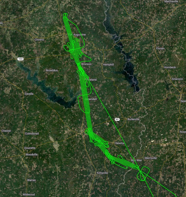
Energy infrastructure spans thousands of miles of difficult terrain. Aerial survey is not optional — it's the only practical way to acquire the data operators need for regulatory compliance, encroachment monitoring, and capital planning. Talos Aviation Group has the aircraft range, sensor capability, and operational discipline to execute energy corridor surveys at scale.
Talk to Our TeamWhat We Fly
Pipeline Corridor LiDAR
High-density LiDAR along gas and liquid transmission lines using the Optech T2000 or Orion M300. Co-collected RGB or NIR imagery via the PhaseOne IXU-1000 for encroachment detection, right-of-way vegetation assessment, and PHMSA-compliant elevation deliverables.
Powerline & Transmission Mapping
Corridor LiDAR for T&D lines, including wire sag modeling, structure detection, and vegetation encroachment flagging. Supports NERC FAC-003 vegetation management requirements.
Oil & Gas Exploration Support
Photogrammetric topographic mapping and orthoimagery for lease area analysis, well pad site selection, and access road planning in remote terrain.
Substation & Facility Surveys
High-resolution orthoimagery and LiDAR for existing facility as-built verification, drainage analysis, and expansion planning.
Solar Farm Pre-Construction
Combined LiDAR and RGB acquisition for grading design, panel layout optimization, and drainage modeling on utility-scale solar sites.
Change Detection & Monitoring
Multi-epoch acquisition to track land use change along energy corridors, quantify erosion, and monitor restoration compliance.
Why Talos for Energy & Utilities
Pipeline and powerline operators need a subconsultant they can call on short notice who understands regulatory requirements, can fly in remote terrain, and delivers clean data the first time. Talos offers dual-aircraft simultaneous operations for long corridors — cutting acquisition days and total project cost.