
The Mission
| Aircraft | Piper Aztec, Turbo Aztec, Commander 500S |
| Mapping accuracy | ASPRS Class I & II compliance |
| GSD range | 2 cm – 20 cm |
| Contour intervals | 0.5 ft, 1 ft, 2 ft |
| Coordinate systems | State Plane, NAD83, WGS84, client-specified |
| Typical turnaround | 8–21 days post-flight depending on scope |
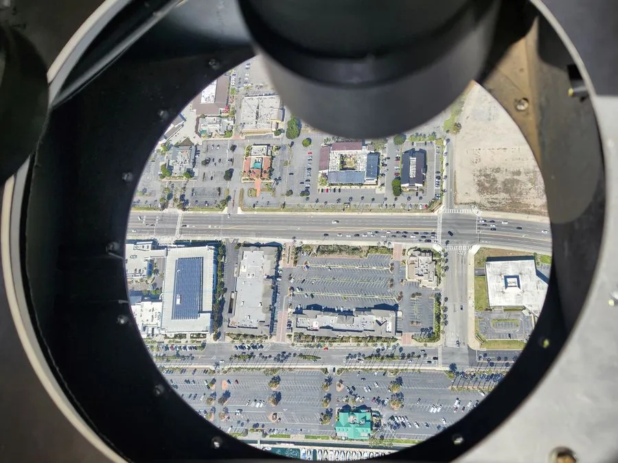
Transportation planning and design relies on accurate, current aerial data. From preliminary alignment studies covering hundreds of miles to detailed design surveys at 3 cm GSD, Talos Aviation Group provides the acquisition backbone that engineering firms need to move projects forward on schedule.
Talk to Our TeamWhat We Fly
Highway Pre-Design & Final Design
Photogrammetric mapping and LiDAR topography for state and local DOT projects. Products meet ASPRS Class I/II accuracy requirements and are delivered in DOT-specified formats.
Rail Corridor Surveys
Long-corridor LiDAR (Optech T2000 or Leica CityMapper2) and co-collected imagery for passenger and freight rail — track geometry, clearance profiling, drainage modeling, and vegetation encroachment.
Bridge & Structure Inspection Support
High-resolution oblique and vertical imagery for bridge condition documentation, supplementing conventional inspection with aerial context.
Airport Obstruction Surveys
FAA Advisory Circular-compliant obstruction surveys for runway protection zone analysis and approach surface verification.
Urban Planimetric Mapping
Detailed feature extraction — roads, sidewalks, driveways, utilities, structures — from high-resolution imagery for municipal GIS and planning departments.
Traffic & Growth Analysis
Multi-temporal orthoimagery for land use change analysis, traffic pattern modeling, and regional planning applications.
Why Talos for Infrastructure & Transportation
Transportation agencies and their engineering consultants need an aerial subconsultant who speaks the same language — ASPRS accuracy classes, State Plane coordinates, DOT deliverable formats. Our crews understand corridor flying and our QC process ensures products don't come back for revision.