
The Mission
| Aircraft | Cessna Turbo 206, Piper Aztec |
| Thermal sensor | FLIR thermal infrared (custom integration, radiometric) |
| Thermal GSD | 8–15 cm at typical survey altitude |
| RGB sensor | Range of RGB sensors (mission-optimized) |
| RGB GSD | 2–4 cm simultaneous with thermal |
| Min. site size | 10 MWac (below this, UAS typically preferred) |
| Typical turnaround | 5–8 business days from flight |
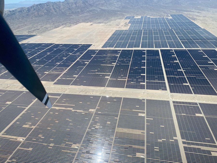
Utility-scale solar farms present a unique inspection challenge: thousands of panels across hundreds of acres must be assessed regularly to maintain performance guarantees and catch failures early. Our custom sensor payload integrates FLIR thermal infrared sensors with a range of high-resolution RGB sensors, mission-optimized for each inspection type — providing simultaneous thermal anomaly detection and visible documentation in a single pass.
Talk to Our TeamWhat We Fly
Thermal Anomaly Detection
Airborne thermal infrared imagery identifies hot spots, bypass diode failures, string disconnections, and cell-level defects invisible to ground inspection or monitoring systems alone.
RGB Orthoimagery for Physical Inspection
High-resolution visible imagery documents soiling patterns, physical damage, vegetation encroachment, tracker alignment issues, and mounting hardware anomalies.
Pre-Construction Site Survey
Combined LiDAR and RGB acquisition for grading design, drainage modeling, and panel layout optimization before ground is broken.
Post-Construction As-Built Survey
Precise as-built documentation of panel and combiner box locations, access roads, and perimeter fencing for owner records and performance modeling.
Vegetation & Encroachment Monitoring
Periodic imagery to track vegetation growth under and around arrays — supporting O&M vegetation management programs and fire risk assessment.
Performance Decline Investigation
Targeted thermal and visible inspection following performance alerts from SCADA systems, identifying root cause of production shortfalls.
Why Talos for Solar Panel Inspection
For sites above 10–20 MW, manned aerial inspection covers ground faster and at higher altitude consistency than drone operations — with no airspace authorizations required below 400 ft and no battery swap logistics. A single Talos flight day can cover 200+ MW of installed capacity.