FLY.
CAPTURE.
DELIVER.
Aerial survey and special mission aviation specialists. We provide mission-ready aircraft and expert crews — you focus on the data, we handle the skies. We fly for mapping firms. We never compete with our clients for their downstream work.
Nationwide coverage · Rapid deployment · No mission too complex
Core Capabilities
Sensor-agnostic platforms with rapid deployment and nationwide reach — from precision mapping to complex special missions.
Photogrammetry
High-resolution imagery and photogrammetry missions across the U.S. and Canada with proven, purpose-configured survey platforms.
Learn more →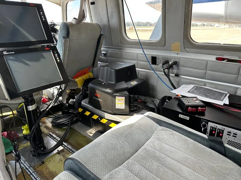
LiDAR Operations
Precision LiDAR collection with large-format camera holes and high-amperage power systems for demanding sensor packages.
Learn more →
Sensor Testing
Flexible platforms for R&D, sensor integration, and test flights — we adapt our aircraft configuration to your payload requirements.
Learn more →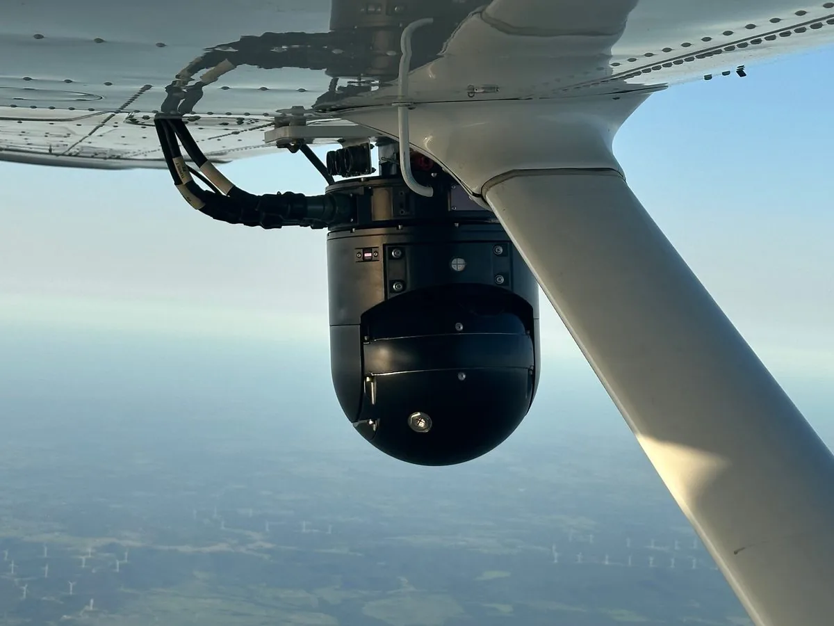
Special Missions
ISR, C4ISR, and government-adjacent airborne missions supported by veteran expertise and reliable aircraft platforms.
Learn more →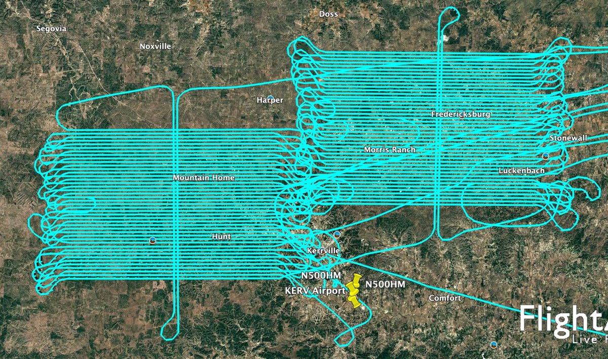
Airborne Mapping
Versatile fleet configurations for geospatial, infrastructure, and environmental mapping missions at any scale.
Learn more →
Managed Flight Ops
End-to-end operations management including qualified sensor operators, mission logistics, and flight planning support.
View fleet →Flown. Delivered. Proven.
Capacity is a promise — performance is a record. Here is ours from the most recent survey season.
Thousands of Miles of Pipeline & ROW
Multiple pipeline and right-of-way programs combining corridor LiDAR with RGB imagery — thousands of linear miles acquired across program seasons, flown to spec and delivered for downstream compliance and engineering use.
Nationwide Photogrammetry Program
Sustained nationwide photogrammetry acquisition — multi-region deployments, repeatable program cadence, and on-time mobilization, cycle after cycle.
Solar Panel Inspection, Coast to Coast
Thermal infrared inspection of utility-scale solar assets with nationwide deployment — anomaly-grade thermal acquisition flown on tight irradiance windows across multiple states.
Large-City RGBN for Commercial Development
Four-band RGB+NIR survey over a major metropolitan area supporting commercial real estate development — dense urban gridwork flown to consistent radiometric and overlap spec.
Client names withheld under standard confidentiality. References available on request for qualified opportunities.
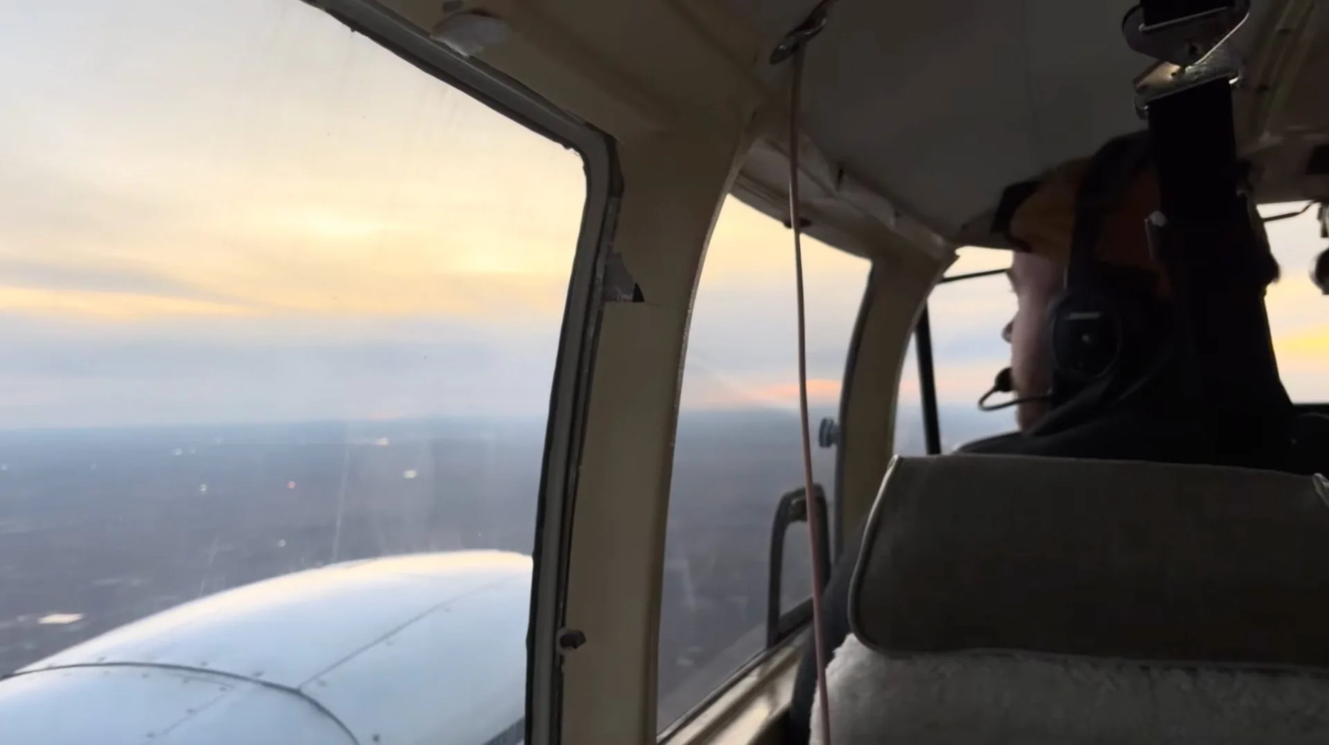
Special Mission Aviation
Few aerial survey companies are equipped — or cleared — to operate in the special missions space. Talos was built by veterans who understand operational complexity, mission security, and the non-negotiable requirement for precision.
Built for Your Mission
Our aircraft and crews operate across demanding environments and industries — from pipeline corridors to post-disaster response zones.
Energy & Utilities
Pipeline inspection, powerline corridor mapping, oil & gas exploration
Infrastructure & Transportation
Road, rail, bridge, and corridor surveys for planning and design
Land Development
Pre-design surveys, topographic mapping, subdivision and site planning
Emergency Management
Disaster response, damage assessment, flood mapping, wildfire perimeters
Mining & Aggregates
Volumetric surveys, stockpile measurement, mine progression mapping
Solar Inspection
Thermal and RGB aerial inspection of solar farms and PV installations
The Talos Advantage
Military veterans who bring mission discipline, operational rigor, and real-world experience to every flight.
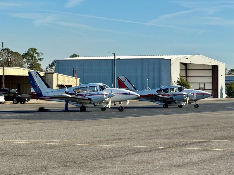
Fleet configured for maximum flexibility — we integrate with your sensor package. Up to 700 lb payloads.
Two strategically located operating bases for fast, responsive coverage anywhere in the continental U.S. and Canada.
Active operations spanning the continental U.S. and Canada — wherever your survey program requires deployment.
Ready to Fly?
Tell us about your project. We'll respond with a tailored proposal, timeline, and quote — typically within 24 hours.